44
Geotechnical News • March 2017
GEOHAZARDS
an earthquake that shook the Shaanxi
province and killed ~830,000 people,
many due to the numerous co-seismic
landslides. The landslide at Elm, in
1881, however, was perhaps the sub-
ject of the first and seminal landslide
investigation (Heim, 1882), and one
that considered geology, structure and
first tried to address the long runout
nature of the event.
In 1904 McConnell and Brock were
sent by the Geological Survey of Can-
ada to determine the cause and nature
of the Frank Slide in what remains, at
the end of 2016, Canada’s deadliest
single landslide (McConnell & Brock,
1904). Their report continues to be
instructive to geohazards specialists
today.
By 1925 the University of Alberta
taught geology to civil engineers (Van-
Dine, Nasmith, & Ripley, 1992). Texts
supporting this work began arriving
in the early 20th Century. In 1929,
Redlich, Terzaghi and Kemp published
their book on engineering geology
(Redlich, Terzaghi, & Kemp, 1929)
and by 1939 Robert Legget published
the first Canadian textbook on the
same subject (VanDine, Nasmith, &
Ripley, 1992).
In 1928, the St. Francis dam failed
in California and killed 426 people
(VanDine, Nasmith, & Ripley, 1992).
Following that event, civil engineers
were unequivocally warned to con-
sider geology as part of the building
process. Similarly, a failure of the
Chingford reservoir in the UK resulted
in England’s adoption of geoscience
into engineering and the UK’s first
geotechnical firm, Soil Mechanics Ltd.
(Winter & Bromhead, 2016).
By 1945, Karl Terzaghi, an Austrian
civil engineer, geotechnical engineer
and geologist who would later be
known as the father of soil mechan-
ics, came to the west coast of North
America. Terzaghi first visited Wash-
ington and then British Columbia,
where he worked with North Ameri-
can engineers on rails, pulp and paper
sites and dams. He was at the time a
civil engineering professor at Harvard
where he taught engineering geology
and lectured on the roles of geology
and geomorphology in civil design
(VanDine, Nasmith, & Ripley, 1992).
Geomorphology and
geohazards
If the science of geology, the struc-
tures and nature of the Earth’s
materials, was incorporated into civil
engineering works in the early 20th
century, the science of geomorphol-
ogy, the form and nature of materi-
als currently affected and/or created
by water (including ice), wind and
gravity, was to take decades longer.
Engineering geomorphology is distinct
from engineering geology in that
while the latter is concerned with how
inherited geological properties (struc-
tures, mineralization, soil strengths
etc…) might impact a design, the
former is concerned with how recent
landforms and modern processes
(the aforementioned wind, water and
gravity) might impact a design. The
study of geohazards was to ultimately
incorporate both.
Quantitative geomorphology emerged,
particularly in the US, as a way to
understand soil loss (the scourge
of the 1930’s) and river dynamics.
Engineering geomorphology in its
broadest sense, however, emerged in
the UK with the likes of Peter Fookes
(frequently referred to as the father of
engineering geomorphology), Denys
Brunsden, Ron Cooke, and later
Mark Lee and Jim Griffiths and first
published as a text in 1986 (Fookes &
Vaughan, 1986)
In Canada geomorphology was com-
ing into its own in the late 1970s.
Widespread landslides and erosion
caused by forest harvesting and road
building were deemed preventable
through a better understanding of
geohazards present in the landscape.
As a consequence, by 1976 British
Columbia formalized a terrain clas-
sification system to systematically
describe geomorphology (Environ-
ment and Landuse Committee Secre-
tariat, 1976). This system was revised
in 1988 (Howes & Kenk, 1988) and
again in 1997 (Howes & Kenk, 1997)
to include a qualitative prediction of
geohazards that might occur following
forest activities.
The next pass
Subsequent decades taught Canadians
much about Geohazards and landslides
in particular. The forestry context
provided an epidemiological setting
against which experiments could be
run and fundamental relationships
could be discerned. The contribu-
tion of geomorphology was suddenly
paramount as pioneers of terrain
mapping (Bruce Thomson, Denny
Maynard, June Ryder, Terry Roller-
son, Terry Lewis and others) began
systematically dissecting the country
and developing relationships between
terrain and geohazards.
At the same time, engineering
geologists and geotechnical engineers
shared their interests in the geology
and geomorphology of specific events
and began to unravel the mechanisms
behind landslides. The numbers of
influential figures in the Canadian
history of geohazards grows rapidly at
this point but perhaps no one con-
tributed more than the prolific trio of
John Clague, Steve Evans and Oldrich
Hungr. They (and others) developed
key concepts used around the world
today including the rock fall shadow,
landslide runout mechanisms and
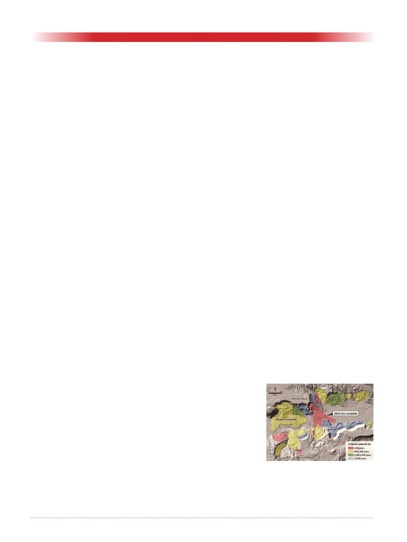
Figure 3. Map of the Oso landslide
in the US Publicly available map
from the Seattle times (http://
old.seattle.times.com/html/local-
news/2023244512_mudslideli-
darxml.html).


