Geotechnical News • December 2016
33
WASTE GEOTECHNICS
The value of using of softcopy mapping tools for siting of
engineered tailing impoundments
Dennis O’Leary and Allison Isidoro
A knowledge of the terrain condi-
tions and geohazards found at a site is
critical to any development, including
tailings storage facilities, landfills or
mine site facilities. The first and most
important consideration in the preven-
tion of environmental impacts is selec-
tion of an appropriate site (EPA 2015).
Failure to do so may have negative
consequences.
A siting assessment is typically the
first step in designing a tailings facil-
ity, landfill or other major infrastruc-
ture. Detailed site investigation data
is often not available at this initial
stage and terrain mapping can provide
excellent information to assess suit-
able locations for the facility, as well
as areas to avoid. Terrain mapping can
provide information over large areas
with relatively minimal effort, which
is key for this initial stage when mul-
tiple locations are often considered.
The stability of Tailings Dams has
recently become a critical issue for
the global mining industry. In order to
improve dam safety in the province of
BC, the Association of Professional
Engineers and Geoscientists of BC
(APEGBC) has recently published
professional practice guidelines for
Site Characterization for Dam Founda-
tions in BC (APEGBC 2016). As
part of these guidelines, the province
requires both bedrock and surficial
geology (terrain) mapping and site
investigation (test pitting or drilling)
to occur early in the overall site char-
acterization phase of a project.
From project planning to develop-
ment, operations and closure, an
upfront knowledge of the soil materi-
als, thickness of overburden material,
presence of buried materials, drainage
conditions and on-going geomorpho-
logical processes (e.g., thaw slides,
seepage, rock fall, etc.) is critical and
can result in significant cost savings in
all phases of a project.
The term “
terrain
” includes (1) soil
material type, (2) topography, (3)
thickness of overburden / depth to
bedrock, (4) drainage, (5) slope class
and (6) geomorphological processes.
Terrain mapping involves the subdivi-
sion of the landscape into relatively
homogeneous and discrete map units
based on these six terrain attributes.
Unfortunately, most terrain data that is
publically available is at coarse scales,
often from 1:1,000,000 to 1:100,000.
At a 1:250,000 scale, a common scale
for surficial geology maps, the mean
polygon size is 2,650 ha (26.5km
2
)
and the mean range of polygons at this
scale is 1,900 to 3,400 ha (RIC 1996).
As a result, some landfills, tailings
impoundments or mine sites may fall
within one, rather heterogeneous ter-
rain polygon!
Terrain units (polygons) at scales of
less than 1:10,000 (e.g., 1:100,000,
1:250,000) often contain consider-
able variability. For example, small
wetlands or organics are often not
mapped unless of significant aerial
extent; rather they may form a part of
a larger upland till or glaciolacustrine
unit. Similarly, small post glacial lake
deposits are not identified within a
larger till unit, however it is common
that in the description of the till unit,
there may be a statement alluding to
the fact that there may be some glacio-
lacustrine and glaciofluvial sediments.
Although it is understood that these
large units have a mix of soil materi-
als, their extent and aerial location is
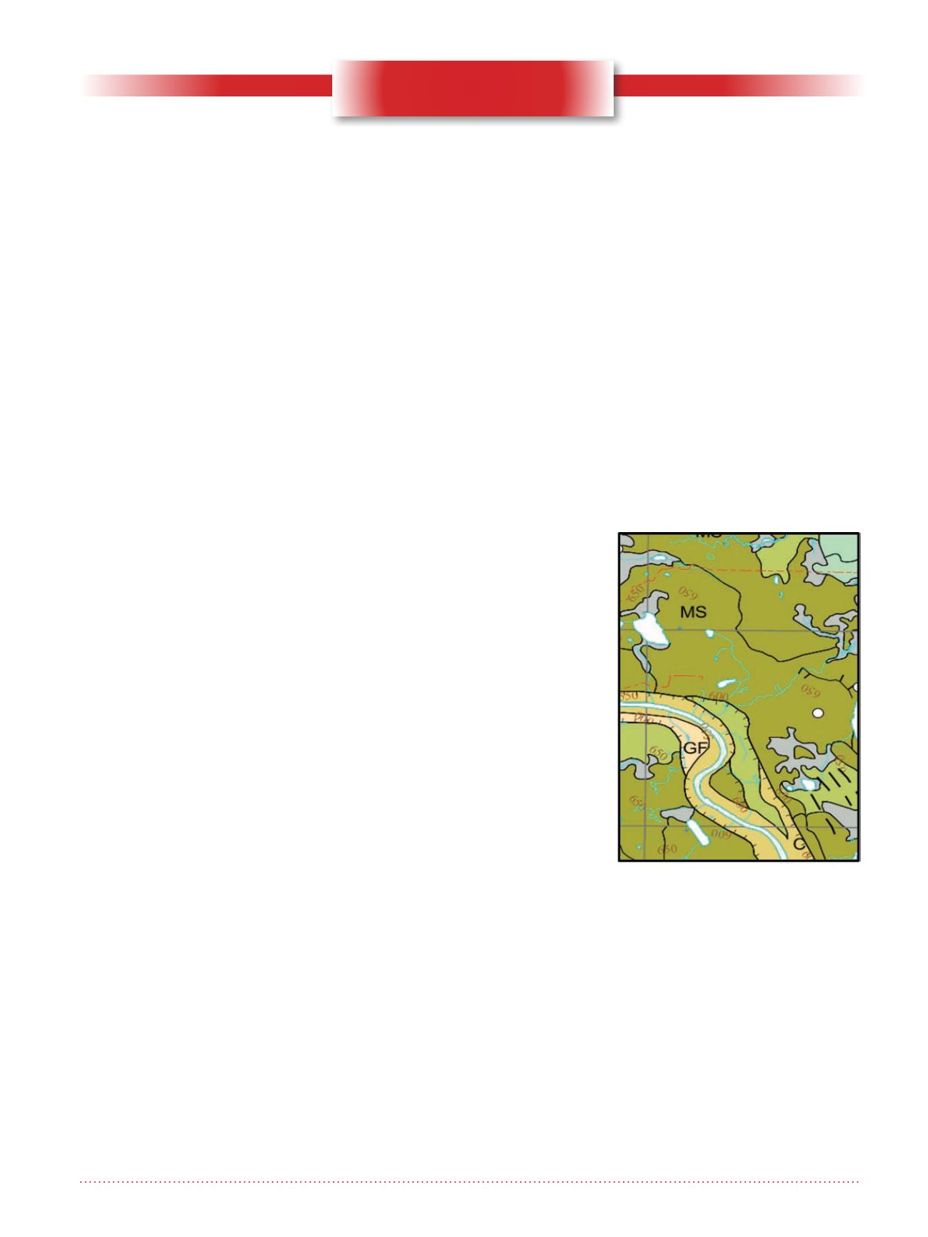
unknown at small scales (Figure 1).
Existing publically available maps
from the federal, provincial and state
agencies provide valuable data on
general material types and landforms.
However, they do not provide data
that is necessary to support operational
developments, including the siting of
tailing impoundments or landfills.
Figure 1. Sample 1:250,000 scale
surficial geology map; MS –
stagnant ice moraine, FG –
glaciofluvial, C – Colluvium. Area
shown is approximately 100 km
2
.


