36
Geotechnical News • December 2016
WASTE GEOTECHNICS
Figure 8 shows full terrain mapping
for the area at a scale of 1:2,000 (from
the original 1:30,000 scale aerial
photos), including two similar water
impoundments as shown in Figures
5 - 7. Area mapped is approximately 1
km
2
(0.4 mi
2
).
Figures 9 – 11, again using 1:30,000
scale B&W stereo aerial photographs
show similar utility in mapping tailing
impoundments.
If water impoundments and tail-
ing facilities can be mapped to such
accuracy then terrain features that
are important in the siting of tailings
facilities, dam structures, landfills,
and mining infrastructure can also be
mapped in greater detail. As stated
above, the first and most important
consideration in the prevention of
environmental impacts is selection of
an appropriate site (EPA 2015).
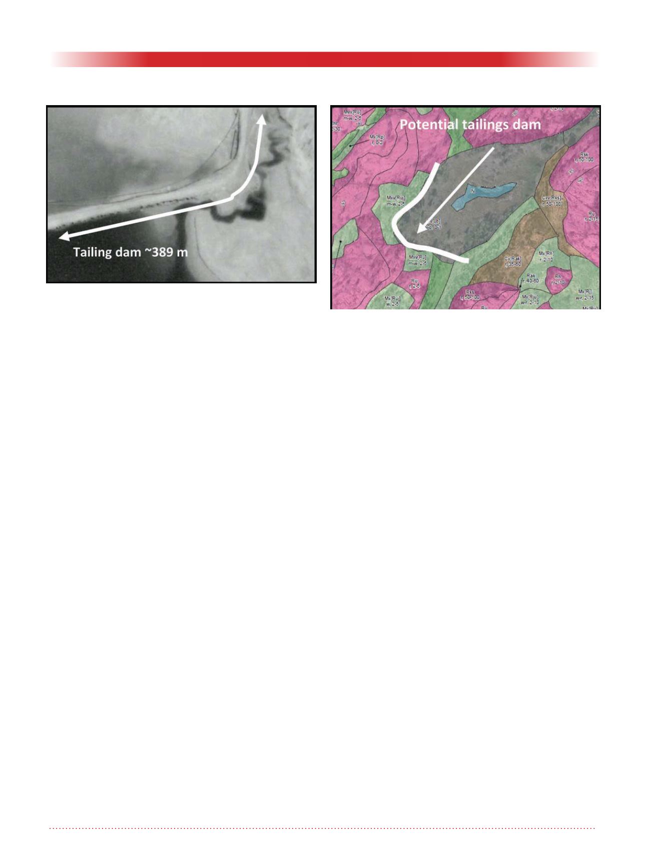
Figure 12 shows detailed terrain map-
ping at a scale of 1:1,000 for a bed-
rock controlled landscape in northern
Canada. The areas in pink are bedrock
dominated; the light green areas
thin till (<20cm) materials overlying
bedrock; the grey area in the center is
a low area where thin (<50cm) organ-
ics are found overlying bedrock. The
small blue water area in the middle of
the depression is from snowmelt and
rainwater; studies indicate that the
water is not tied to local groundwater
conditions. Hence, this location could
provide a suitable site for a tailings
facility with the dam being placed
along the southwestern portion of the
wetland; the topography slopes very
gently to the southwest with bedrock
controlled slopes on the northwest and
southeast flanks of the depression.
Detailed terrain mapping using
softcopy tools allows for the bet-
ter identification of soil materials,
topography overburden thickness/
depth to bedrock, drainage conditions,
slope gradients and geohazards. This
desktop mapping exercise represents
the front end to a proper geotechnical
investigation. Because the mapping
can be done to such detailed scales, it
allows for the better siting of poten-
tial boreholes or other geotechnical
investigations and tools such as, cone
penetrometer tests, slope inclinom-
eters, tiltmeters, extensometers and
piezometers.
It is critical that terrain mapping be
completed by qualified terrains scien-
tists. Individuals must have a thorough
understanding of local geological
conditions, including glacial history
and on-going geological processes
such as permafrost, landsliding, high
water tables, etc.
References
Association of Professional Engineers
and Geoscientists of BC. 2016.
Site Characterization for Dam
Foundations in B.C. APEGBC
Professional Practice Guidelines
V1.0
Environmental Protection Authority
(EPA). 2015. Siting, design, opera-
tion and rehabilitation of landfills.
Publication 788.3. Victoria.
Resource Inventory Committee (RIC).
1996. Guidelines and standards
to terrain mapping in British
Columbia. Surficial Geology Task
Group, Earth Sciences Task Force,
Victoria, B.C.
Sommerville, A., D. O’Leary, M.
Nixon, A. Kumah and G.W.
Wilson. 2016. Use of softcopy
technology for soil and terrain
characterization. GeoVancouver
2016.
Dennis O’Leary and Allison Isidoro
Golder Associates Ltd.
16820 107 Avenue,Edmonton,
Alberta, T5P 4C3
T: 780-483-3499, F: 780-483-1574
E: Dennis_O’Leary@golder.com
E:
Figure 11. 1:30,000 scale image zoomed into at 1:1,000
scale.
Figure 12. Detailed terrain mapping at a scale of 1:1,000.


