Geotechnical News December 2011
25
GEOTECHNICAL INSTRUMENTATION NEWS
Highlights
As could be seen from the high number
of participating companies and the
many outstanding presentations, the
geotechnical monitoring industry
has grown in size and quality since
the previous FMGM in Boston, USA
four years ago,. Also the industry has
matured. There are both manufacturers
of instrumentation and software who
proved a few specialized products, and
also a large number of manufacturers
capable of supplying a wide range of
instruments. A listing of these many
companies, together with products
and web addresses, is given by
John Dunnicliff in the symposium
proceedings. Another sector of
companies provides the full service of
installing, monitoring, presenting data
and maintaining.
An absolute eye-opener was the idea
of on-site visualization of measure-
ments as shown by Shinichi Akutaga-
wa (Japan). A case was presented
where the forces in a strut and move-
ment of the walls of an excavation
were visualized directly in the building
excavation. The system consists of a
small programmable datalogger with
LED illumination (blue-green-orange-
red) connected close to the sensors and
displaying the safety level of forces in
the struts or movement of the retain-
ing walls. Workers, supervisors, en-
gineers, staff and also the public can
immediately see when safety levels
are exceeded so that a response can be
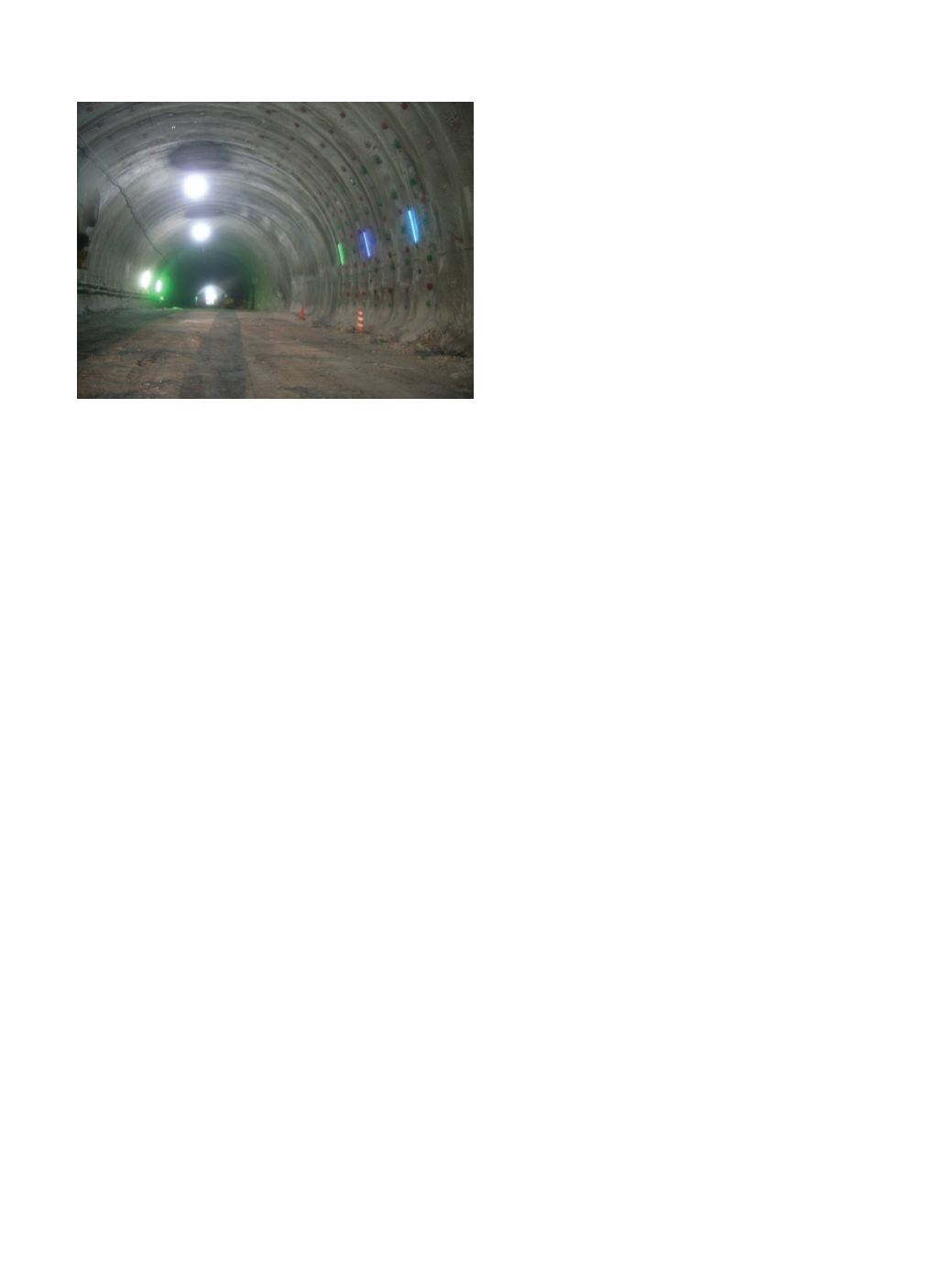
initiated. Figure 2
shows a different
case of the same
system in a tun-
nel, visualizing
convergence dis-
placement.
How to cre-
ate a smart le-
vee? This was
a typical Dutch
question raised
by Victor Hop-
man (The Neth-
erlands). Many
river deltas in
the world are of
great economic
value. However,
in general these areas are susceptible
to flooding because of the low level of
the land. In The Netherlands, with over
50% of the land below sea level, pro-
tection against flooding is in the form
of 17,000 km of artificial levees and
flood defense structures such as storm
surge barriers. In the Netherlands, rel-
evant research in the past few years
has been concentrated on full-scale
field experiments on levees, mainly
related to the so-called IJkdijk project
(
). At a special test site
in Groningen on one large levee, the
slope stability failure mechanism has
been investigated thoroughly by a wide
range of sensors. Four smaller levees
have been subject to backward seepage
erosion (piping), again monitored by a
large suite of sensors.
Tunneling and underground con-
struction are a major challenge in ur-
ban areas, with the potential risk of
failure and influence on the surround-
ings to the project. Many papers during
the symposium dealt with this subject.
Martin Beth (France) gave an over-
view and his reflections at the use of
monitoring to meet the requirements of
controlling these risks during excava-
tion. New technologies were discussed
showing their strengths, weaknesses
and usability in an urban environment.
Testing of a large fiber-optic strain-
rosette embedded in a landslide area
was discussed by Johannes Wöllner
(Austria). Landslides are unavoidable
natural processes in alpine regions,
often associated with economic and
social disasters. Therefore large ef-
forts have been made to investigate the
causes and mechanisms of landslides,
using accurate monitoring techniques.
For this purpose a new measurement
system, an embedded strain-rosette
was developed, consisting of three
long-gauge fiber-optic sensors. Long-
term deformations as well as rapid de-
formations were investigated at the test
site Gradenbach.
The fully-grouted method for instal-
lation of piezometers in boreholes was
discussed often. Iván Contreras (USA)
and Lucia Simeonia (Italy) presented
papers on the practical and scientific
aspects of that method, indicating its
major benefits. A new discussion could
be the influence of casing and backfill-
ing of the borehole of an inclinometer
installation for vertical probe incli-
nometer measurements, as started by
Michael Alber (Germany). The labora-
tory tests conducted have proved that
that even in hard rock conditions the
best suited backfilling materials should
have a low shear strength. It could be
demonstrated that under these labora-
tory circumstances sand seemed the
best filling material reflecting the ini-
tial displacements. However I have to
comment that sand is a filling mate-
rial that is difficult to use in practice.
The problem is how to fill the whole
borehole properly with sand at a certain
density, and in practice in the field this
is verging on the impossible.
The Rasnik Optical-Electronic
Alignment System has been developed
for monitoring the alignment of detec-
tors at particle physics experiments at
CERN (Conseil Européen pour
la Re-
cherche Nucléaire), Switzerland. Rob
van der Salm (The Netherlands) ex-
plained this high-precision instrument
for monitoring displacements in three
directions. It consists of a back-illumi-
nated coded mask, a lens and a pixel
image sensor. An image of the mask is
projected on to the sensor by means of
the lens. If one of the three components
is displaced in a direction perpendicu-
lar to the optical axis, then the image
on the sensor shifts proportionally, to
be registered by the readout system of
the image sensor. A displacement in the
Figure 2. Visualizing convergence displacement of a tunnel.
(Picture courtesy of Nexco East and Konoike Construction).


