30
Geotechnical News December 2011
GEOTECHNICAL INSTRUMENTATION NEWS
Salt Cavern Monitoring System for Early
Warning of Sinkhole Formation
Bill Shefchik
Reynold Tomes
Riccardo Belli
Introduction
The city of Hutchinson is located in
Reno County, Kansas. Hutchinson is
on the route of the trans-continental,
high-speed mainline of one of the
nation’s largest railroads. The railway
passes near a former salt mine well
field, where mining was carried out in
the early part of the twentieth century.
The salt mining was performed at
depths of over 400 feet by drilling
wells through the shale bedrock into
the thick underground salt beds, and
then pumping fresh water into the salt,
dissolving the salt to be brought back
to the surface as brine, for processing
and sale. This solution mining process
resulted in the presence of multiple,
large underground voids and caverns,
which have been reported to be up to 300
feet tall and over 100 feet in diameter.
In places, the shale roof rock over some
of these old mine voids has collapsed,
forming crater-like sinkholes that can
be over 100 feet in diameter and 50
feet deep at the surface. The collapse
and sinkhole formation can occur very
rapidly, over a period of hours to days.
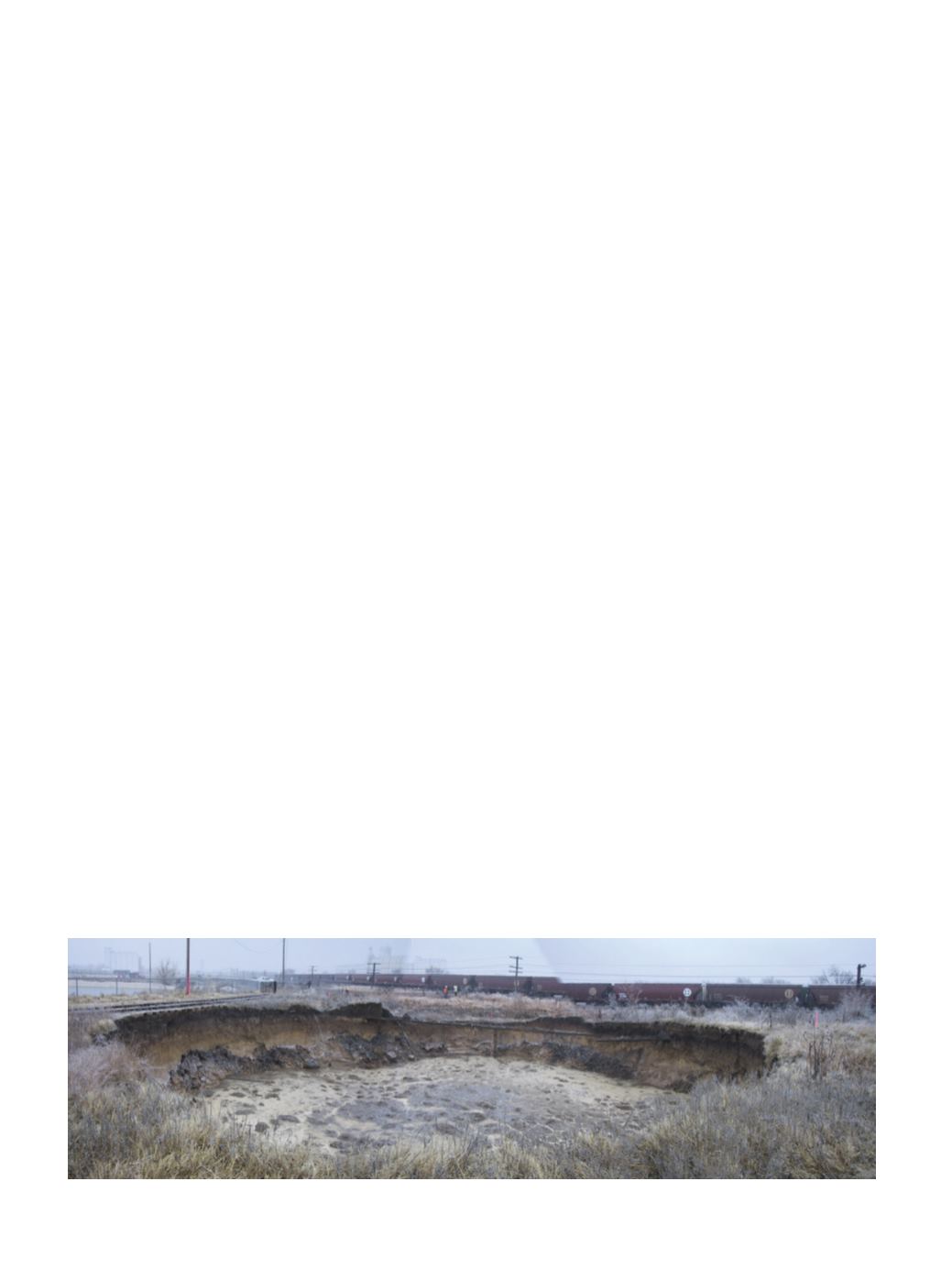
Figure 1 is a photograph of a sinkhole
that opened up virtually overnight at
this site in 2005, by collapse of a salt
cavern that was last mined in 1929. The
potential rapid formation of sinkholes
by collapse of old mine caverns clearly
represents an issue for ground stability
and a non-negligible safety risk for
surface infrastructure, including the
railway.
Monitoring Solution
An area on the site containing old,
potentially unstable salt caverns
adjacent
to
sensitive
surface
infrastructure was identified with
the aim of establishing an effective
monitoring system in order to provide
early stage detection, continuous
monitoring, and automatic telemetry.
Arrangements were made for alerting
via cell phone and email, in case of
ground deformation (strain) that may be
the early signs of sinkhole formation.
The distributed fiber-optic (FO)
monitoring system (Inaudi and Glisic,
2007) was selected in large part because
it provides thousands of monitored
points using a single fiber-optic sensing
cable, all measured at the same time,
in a single scan. This is well-suited to
defining a monitored perimeter where
the exact location of where a sinkhole
might form is not known precisely. In
addition, this monitoring system was
selected because of the ease of installa-
tion by burial in a shallow trench.
In a geotechnical project like this,
the selection of the sensing cable repre-
sents a key aspect, and at the same time,
a big challenge: the sensing cable needs
to be capable of withstanding hostile
environmental conditions, such as
wide temperature variations and burial
in the ground, as well as being resistant
to burrowing rodents. At the same time
the cable needs to be sensitive enough
to provide early and reliable displace-
ment detection of settlement of ap-
proximately 10 mm in magnitude,
ac-
cording to soil type and characteristics.
It must also be capable of optimizing
the transfer of forces from the ground
to the fiber, even through the various
cable protective layers, which in this
case includes a steel ribbon wrapping
to resist gnawing by rodents.
The sensing cable is directly buried
at a depth of approximately 1.4 meters,
(4 ft), over a potential sinkhole area
above and around salt caverns over a
path with a total length of over 4 km,
(13,000 ft) – see Figure 2.
After digging the trench, the silty
soil was mechanically compacted, and
the sensing cable laid on the compacted
soft ground before the trench was back-
filled. The sensing cable was installed
in several segments in order to provide
easier handling during installation, and
Figure 1. Sinkhole formed rapidly in 2005, at Old Brine Well at the Hutchinson site.


