Geotechnical News • September 2018
21
COMPUTING IN GEOTECHNICAL ENGINEERING
From the GS Board
edged in Part 4. The author, however,
accepts responsibility for any errors
or misinterpretations of facts. If
readers have additional information,
or comments, on the history of the
development of the
CFEM
and the
MCIF
, please send them to
References for Part 3
Canadian Geotechnical Society
(CGS), 1992, Canadian Founda-
tion Engineering Manual, 3rd
Edition, published by the CGS c/o
BiTech Publishers Ltd., Vancou-
ver, BC, 512 p.
Société Canadienne de Géotechnique
(SCG), 1989, Manuel Canadien
d’Ingénierie des Fondations,
published by the CGS c/o BiTech
Publishers Ltd., Vancouver, BC,
378 p.
Société Canadienne de Géotechnique
(SCG), 1994, Manuel Canadien
d’Ingénierie des Fondations, 2ème
Édition, published by the CGS c/o
BiTech Publishers Ltd., Vancou-
ver, BC, 558 p.
Inuvik to Tuktoyaktuk Highway
This is the CGS Cold Regions Geotechnology Division’s first contribution to the “From the CGS Board” portion of
Geotech-
nical News
. In it, Ed Grozic, of Tetra Tech Canada Inc., describes the challenges, design and construction of Canada’s first
highway entirely constructed on continuous permafrost terrain. Jack Seto, Chair CGS Cold Region Division.
Introduction
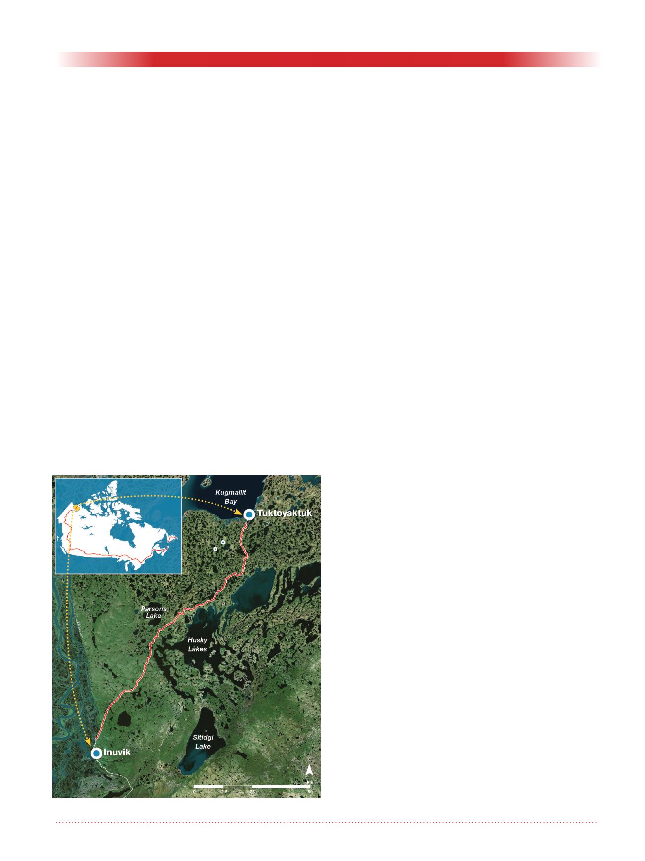
The Inuvik to Tuktoyaktuk Highway
(ITH) is the first Canadian highway
constructed entirely on sensitive, ice-
rich, continuous permafrost terrain,
and is the only Canadian highway to
the Arctic Ocean. The 137-km two-
lane, gravel surface road connects the
communities of Inuvik and Tuktoyak-
tuk, Northwest Territories (Figure 1),
and was opened on November 15,
2017.
The owner, the Government of the
Northwest Territories, required the
highway to be resilient, cost-effective
and constructible, with foreseeable
maintenance costs for a 75-year design
life. The project involved placing
approximately 4.8 M m
3
of embank-
ment fill, constructing 8 bridges and
installing over
300 culverts.
Maintaining the
existing per-
mafrost condi-
tion was a key
element in the
design and con-
struction of the
highway. If the
underlying, ice-
rich soils were
to thaw, the road
embankment and
subgrade could
become unstable
through loss of
soil strength and
thaw-settlement.
The design
approach was to
construct a ‘fill-
only’ embank-
ment to insulate
and maintain the
underlying permafrost condition, thus
creating a stable, permanently frozen
foundation.
Detailed planning commenced in
2008; an environmental impact
statement was issued in 2011; envi-
ronmental reviews extended through
2012 and formal approval was given
in early 2013. Geotechnical investiga-
tions were undertaken during win-
ters of 2012 and 2013. Construction
commenced in early 2014 and was
completed in late 2017, with the work
primarily undertaken in the winter
months. The prime contractor, was
EGTNW Ltd., a joint venture between
Tuktoyaktuk-based E. Grubens Trans-
port Ltd. and Inuvik-based Northwind
Industries Ltd. Construction advanced
from both communities.
Environment
Permafrost.
The ITH is located within
a zone of continuous permafrost.
Permafrost is defined as a ground con-
dition that remains at or below 0˚C for
at least two consecutive years. Along
the alignment, ground temperatures at
depth range from -2˚C to -5˚C. Where
there is organic cover, the thickness of
the active layer (the surface layer that
freezes every winter and thaws every
summer) varies between 0.6 m and
1.5 m. On elevated, exposed and south
facing slopes, the active layer can be
>2.0 m.
Figure 1. Inuvik to Tuktoyaktuk Highway location.


