28
Geotechnical News • December 2018
COMPUTING IN GEOTECHNICAL ENGINEERING
From the GS Board
Leveraging Three-Dimensional Remote Sensing
in Geotechnical Engineering
Matt Lato
Dr. Matt Lato, of BGC Engineering
Inc, presented the 42
nd
CGS Col-
loquium during GeoEdmonton 2018
in September. The following is an
expanded abstract of that presenta-
tion. It is expected that Matt will write
up his presentation and submit it for
publication in the near future.
Robust and effective geotechnical
outcomes emerge when the design is
based on a thorough understanding
of the geology and the environment,
and the interaction of these systems
over time. Traditionally, a signifi-
cant challenge faced by geotechnical
professionals is our ability to observe,
interpret, and understand the physical
environment, particularly as it applies
to changes over time, and the effect
of those changes. Examples of such
changes include the displacement of
a highway crossing a landslide, the
effect on a pipeline crossing under
a meandering river with shifting
sediments, a dam deforming due to
reservoir filling, or movement of a
foundation due to permafrost degrada-
tion. State-of-the-art 3-dimensional
(3D) data collection and analysis tech-
niques are expanding our mapping and
monitoring abilities, opening doors
to solving problems with confidence
previously not possible.
Traditional methods of identifying and
mapping change on geotechnical proj-
ects have been limited to point-based
systems, such as survey prisms, that
require significant time, effort and cost
to establish, monitor and interpret.
These systems involve sparsely dis-
tributed nodes physically mounted to
the ground surface that cannot be used
easily to understand the 3D mechan-
ics of large-scale movement, nor can
they be used to map change over large
areas or long periods of time with
unknown rates of movement. Tradi-
tional methods also rely on a priori
knowledge of where change, move-
ment or deformation is likely to occur,
in order to optimize the placement of
monitoring instruments. New methods
were needed.
In the mid-2000s, the application
of Light Detection and Ranging
(LiDAR)-based technologies for
evaluating natural and constructed
environments started gaining the
attention of geotechnical researchers.
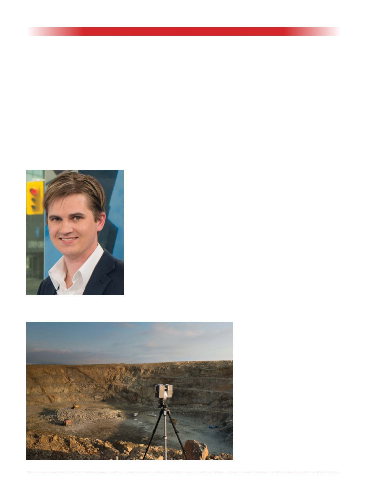
LiDAR is a 3D remote imaging tech-
nique that can generate high-resolution
(up to thousands of points per square
metre) surface models (topology).
LiDAR data can be collected from tri-
pods at static locations (Figure 1), and
from moving cars, boats, unmanned
aerial vehicles (UAVs), helicopters
and airplanes. LiDAR opened the pos-
sibility to monitor sites and to conduct
detailed analysis of topographical
change not reasonably practical with
earlier stationary instruments.
Early research projects focused on
applications of LiDAR technology
at specific study sites to demonstrate
proof-of-concept examples within the
geoscience and engineering commu-
nities. But, like many new technolo-
gies, while LiDAR was emerging as a
viable technology, data collection was
expensive, processing techniques were
not well understood or documented,
Figure: 1. Terrestrial LiDAR scanner collecting data at an open pit mine.
Matt Lato.


