Geotechnical News • December 2018
31
GEOHAZARDS
acceptability, specific hazards related
to debris flows and landslide dams
related to volcanism. The proceedings
remain on my bookshelf today. Since
1992, the Canadian understanding of
thematic elements widely discussed
in the first conference has grown dra-
matically. Some key events (from the
writer’s perspective) in the history of
this growth include:
• 1994: The Kwun Lung Lau land-
slide in Hong Kong (HK) mate-
rially affected the Slope Safety
System employed by HK. While
not widely known in Canada at
the time, increased effort to reduce
risk including use of FN curves
and establishing tolerable risk
limits, would ultimately guide
Canadian practice.
• 1995: The Forest Practices Code
was enacted in British Columbia.
This act (and subsequent pro-
grams) pushed the assessment
and management of geohazards
(landslides, streams, flooding,
erosion) into legislation and cre-
ated the catalyst that gave rise to a
new cohort of active scientists and
engineers investigating and ana-
lyzing data, delivering geohazards
programs, and creating more than
15 years of related literature.
• 1996: The US Transportation
Research Board released Special
Report 247: Landslides – Investi-
gation and Mitigation. Building on
previous work beginning in 1972,
this volume became a definitive
tool for a common understanding
about landslides (including an up-
date to the Varnes classification).
• 1997: The workshop on Landslide
Risk Assessment in Honolulu
Hawaii. This landmark workshop
brought together multiple special-
ists to understand how to use new
tools in hazard and risk assess-
ment.
• 1997: Conrad Siding debris flow in
BC derailed a train and caused 22
million dollars in damage.
• 2002: Zymoetz River rock slide
debris flow in BC ruptured a
pipeline, triggered a forest fire and
dammed the Zymoetz river. 300
people were evacuated, and the
cost was estimated at 33 million
dollars.
• 2005: Berkley Escarpment land-
slide in the District of North
Vancouver (DNV) caused the
evacuation of 300 people, the loss
of 2 homes and cost over four
million dollars. More importantly,
DNV became the first community
in Canada to fully engage in a
landslide risk assessment program
and develop tolerability thresholds
for new and existing development
(based largely on the HK work).
• 2007: The Intergovernmental Panel
on Climate Change published and
won a Nobel Peace Prize for its
Forth Assessment Report. Almost
two decades after its inception, the
focus on mitigation and adaptation
garnered widespread acceptance
and caused a sea-change in the un-
derstanding of a dynamic vs. static
earth. Widespread acceptance led
to flood protection works and the
notion of building resilient com-
munities across North America.
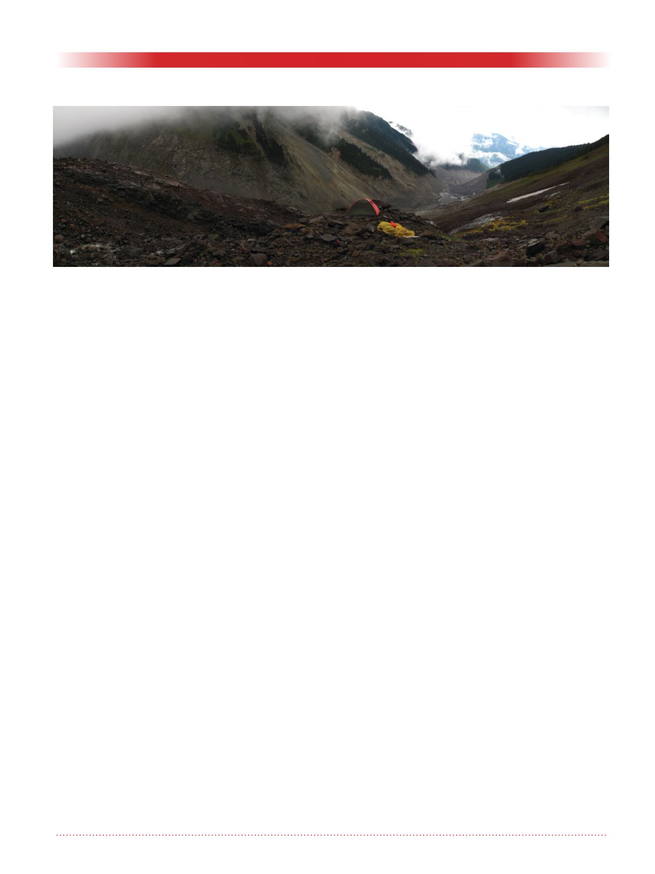
• 2010: Mount Meager landslide oc-
curred (from the complex identi-
fied as problematic in Geohazards
1) becoming Canada’s biggest
historical landslide at 52 mil-
lion square meters. 1,500 people
evacuated due to potential for
damage because of a landslide
dam outburst flood associated with
the landslide. Total cost was ten
million dollars. New updates to the
landslide have been acquired with
structure from motion technology.
• 2010: Saint Jude lateral spread in
sensitive marine clays, Quebec.
At 6.5 million dollars of damage,
this landslide also reminded the
community about the considerable
dangers of spreads, compound
landslides and flow slides. This
landslide type is typical of the
marine clays in Quebec, but also
reminiscent of the weak shales
and glaciolacustrine soils in the
Interior Plains (where, perhaps
surprisingly, the most money is
currently spent on landslide assess-
ment, monitoring and mitigation).
Improved analytical power also
means that these landslides are
better understood than ever before.
Figure 2. Room with a view – looking out at the devastation caused by the 2010 Mount Meager landslide
(photo by R. Guthrie).


